
DOWNLOAD THE APP


Customer Services
Copyright © 2025 Desertcart Holdings Limited
DOWNLOAD THE APP
📍 Survey Smarter, Not Harder — Precision That Puts You Ahead
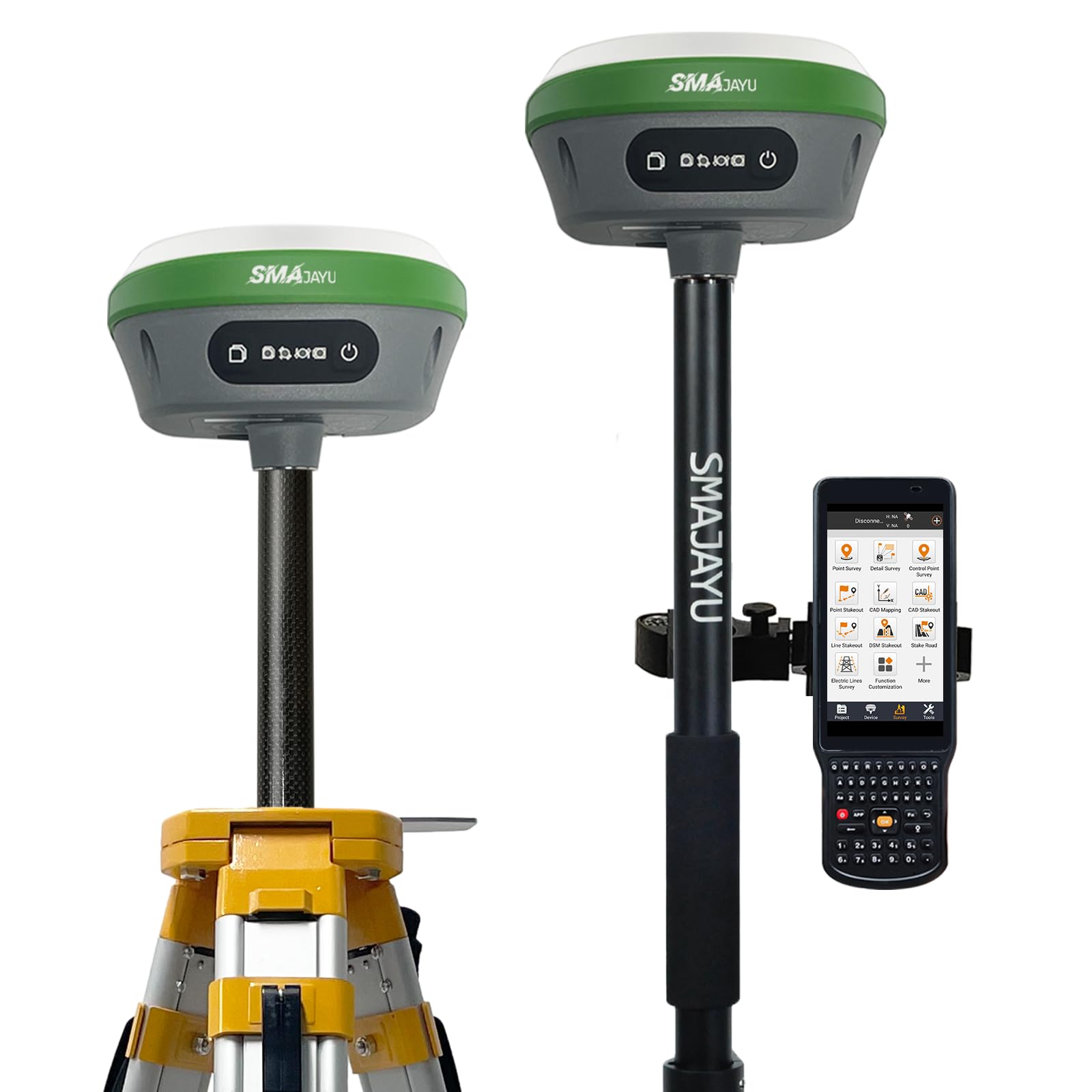
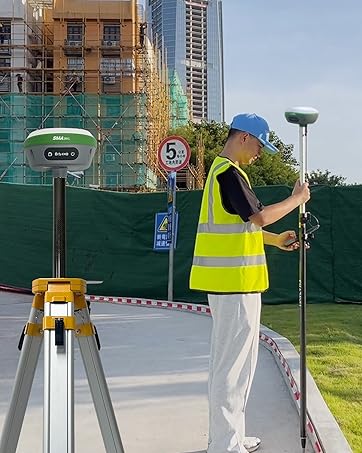
The SMA26 GNSS IMU RTK GPS Surveying Equipment is a NOAA-certified, handheld rover and base system featuring 1408 satellite channels and 1cm RTK accuracy. Designed for professional surveyors and engineers, it supports multiple constellations (GPS, GLONASS, BDS, GALILEO, QZSS) and offers versatile connectivity options including WiFi, Bluetooth, and USB-C. With up to 10km wireless range, 2-day battery life, and advanced IMU tilt compensation, it delivers reliable, high-precision data for topographic, construction, agricultural, and mining applications.


| ASIN | B0BYCR3VQQ |
| Best Sellers Rank | 196 in GPS Module Receivers |
| Department | mens |
| Guaranteed software updates until | unknown |
| Item model number | SMA26 RTK |
| Manufacturer | SMAJAYU |
| Product Dimensions | 13.97 x 13.97 x 8.64 cm; 9 kg |
A**O
MUY BUEN PRODUCTO YA LLEVO MAS DE DOS MESE CON EL, EL GNSS R26 - V2 ES MUY BUEN PRODUCTO YA QUE TIENE CALIBRACION DE LA NOAA PARA PROCESOS PPP ARROJA MUY BUENOS RESULTADOS AUN EN CIUDAD Y A CIELO ABIERTO MUCHO MEJORES POR EL METODO ESTATICO. EN RTK LA UNIDAD DE MODULO INERCIAL ES DE GRAN AYUDA YA QUE HAY PUNTOS DIFICILES Y TE AYUDA MUY BIEN. EN RESUMEN UN EQUIPO QUE VALE MUCHO LA PENA ADQUIRIRLO.
V**Z
Fuera de la excelente calidad del producto, la atención post compra es insuperable, todas las dudas que he tenido las han contestado con satisfactoria claridad, dan un seguimiento personalizado e inclusive te comparten videos tutoriales de los pasos a seguir para atender los diferentes puntos del proceso Atte: Ing Jorge Peralta
S**Y
This is a amazing, sophisticated piece of equipment. i purchased to find my property stakes spread all over 50 acres of trees. Like a needle in a haystack. They have the best support i ever come across. I knew nothing of how to work this equipment but i feel their support turned me into a professional. I found all my stakes and saved over 100,000$ Our local land survey charge 5,000$ an acre on open land more with trees. I highly recommend this to anyone, well worth the money, Thank you SMAJAYU
K**.
Amazing survey grade gps system at an unbelivabe price. Manuals are quite poor and Program not necessarily intuitive... But okay tech support. So plan honor month experimental learning curve. I routinely check into MNDOT published monuments within 0.02 H and 0.04 V ... usimg GS12A-MN.ggf geoid file.. and using MNCORS network using AGRTCM34 mount point and BT tethered to cell phone
A**O
Muy buen equipo GNSS, cuenta con muy buena precisión, compactos, graban rinex, son completos y lo que me gustó más fue su colectora, la medición de inclinación y su forma de replantear con camara con la colectora.
Trustpilot
2 weeks ago
2 days ago